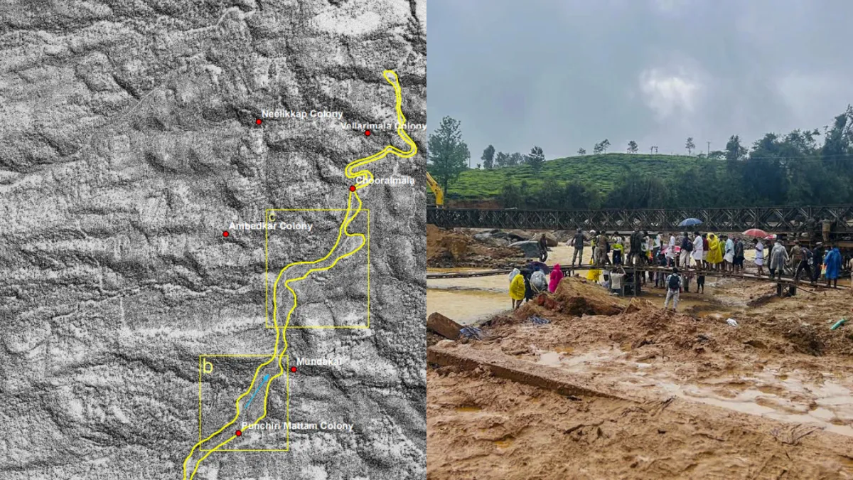
Wayanad landslide (left) satellite image, (right) actual image
The Indian Space Research Organization (ISRO) has released pictures of the landslide accident in Wayanad, Kerala. In these pictures, it can be seen that before the landslide, Wayanad looked beautiful and green. Trees and plants can also be seen. There are also residential areas. However, after the accident, only debris is visible in a large part. Trees and plants have disappeared and houses have also turned into rubble.
Landslides following heavy rains in Wayanad, Kerala have caused great devastation. According to the state’s Health Minister Veena George, 308 people have died in this accident. At the same time, more than 200 people are still missing. In such a situation, the death toll may increase further. Landslide incidents usually occur more in the North Indian states. Sandy land collapses easily when it rains in the newly folded mountains of the Himalayan mountain range. However, this time such an incident has happened in Wayanad, Kerala, in which hundreds of people have lost their lives.
How much was the loss?
Satellite images of Wayanad land slide reveal extensive damage. ISRO’s National Remote Sensing Centre (NRSC) in Hyderabad has released high-resolution images taken by satellites of the landslide-hit area of Wayanad. The NRSC has released before and after images of the July 30 landslide at Choorlamalla in Wayanad district. The images show that the landslide swept away about 86,000 square metres of land. The images were taken by the Cartosat 3 satellite on May 22, 2023, and by the RISAT satellite on July 31, a day after the landslide.
8 km long landslide
The NSRC said that a massive debris flow was triggered by heavy rainfall in and around Choorlamla. Very high resolution RISAT SAR images of July 31 show the same massive debris flow from the crown to the end of the run-out zone. The estimated length of the landslide flow is 8 km. The images released by the NRSC also show evidence of earlier landslides at the same location, making it clear that the crown zone is a reactivation of an old landslide.
86,000 m³ of scrap
The size of the main scrap of the landslide is 86,000 square meters. The debris flow widened the course of the Iruvinpuzha and Mundakkai rivers, causing them to break their banks and the flow destroyed villages and houses located on the banks. ISRO has done a detailed WT of ground zero to explain these pictures.
Read this also-
Video: SDRF soldiers rescuing pilgrims in Kedarnath, saved the lives of more than 2200 pilgrims
Olympic medalist Swapnil Kusale is in luck, first there was a rain of money, now promotion has also been announced
Latest India News